Explore and sustain the James River Watershed
Learn

News & Events

Project Description
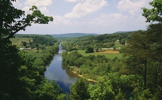
The Conservancy worked with National Geographic Maps to produce a new educational and outreach map for the James River watershed. The map highlights the region’s geography, American Indian history, Captain John Smith’s adventures, recreation, wildlife assets, challenges facing the watershed, opportunities to address those challenges, and the Envision the James initiative. Download a the map or contact Emily for a hard copy.
Project Website
Lead Organization
Chesapeake Conservancy
Other Partners Involved
James River Association, National Geographic Maps
Status
Completed
Comment
Submit
You Might Also Like

Deep Bottom Park
Envision the James University of Richmond Assistant, Connor Flanagan, will be leading a trail

Belmead Riparian Buffer Project
The James River Association and Chesapeake Conservancy have partnered with the Sisters of the